Sunday, September 30, 2012

More Evidence Of Flaked Stones On Mars

 
  Some Sol 54 MAHLI images show more evidence of stone flaking on Mars. This may be because basalt flakes easily. Stones were flaked to make tools by our human ancestors and some of their predecessors. People should be advised not to draw the wrong conclusion from this evidence.


Saturday, September 29, 2012

Posturing On The Alluvial Fan

 
  An alluvial fan by definition is formed by the action of water. But in adopting an Earth-based or restricted point of view we can introduce a perceptual illusion like that of a mirage when we see water when it is not actually present. One finds geological features on Earth which are similar in appearance to the alluvial fan such as debris flows and other forms of mass wasting. An interesting case is that of the talus cones seen found in Svalbard.
 
src: Wikipedia
 
  Note in the image above that for each talus there is a funneling cone at the top, a channel and a debris field below. One can identify similar features at Gale Crater on Mars. Mountains to the north of the crater rim can act as a funneling cone. There is also a channel through the crater wall and a debris field but the slopes differ. The structure is somewhat like that of the Galton board which was introduced to illustrate the normal distribution. It too has a funnel, a channel and a cascade through which objects fall. The fan and the talus cone are flow fields for the material that is deposited below the channel. In the case of the alluvial fan one could generalize and to include some other flow field besides that of water to move material about. Mt Sharp appears to be more consolidated than the material around it since it appears to have withstood erosion better but we will have to wait and see what the actual data turns up before we can speak with any authority. Referring to an alluvial fan is just a first impression.
 

Friday, September 28, 2012

Sol 52 Anaglyphs - Rougher Terrain Ahead

 
  Emily Lakdawalla did a blog today with a map showing Curiosity's progress to Glenelg up to Sol 52. Today's anaglyphs show that the terrain will be getting more difficult from now on.


What Was The Gale Crater Stream Source?


  It's been claimed that there was once water flowing down the alluvial fan in Gale Crater and one might ask what was its source? The image above shows an Google Mars elevation profile for a path through the channel at the crater rim and down the alluvial fan. The area just to the north of the crater wall seems to have been filled in with material. Going farther north uphill one comes to what appears to be an eroded crater. Could this be a volcanic crater that has collapsed? Water is not necessary to explain the filled in material. It could have been blown in over a very long period of time. But could this collapsed crater or Mt Sharp have been a mud volcano? An underground source of churning mud might produce rounded stones like those from a rock tumbler and require less water to do so. A subsequent eruption could have deposited the material on the alluvial fan. We need to keep and open mind when it comes to an alien planet and perhaps the rock tumbler would be a good test that the proponents of flowing water on Mars would have to pass to prove their case. Appearances can be deceiving at times.
 

Thursday, September 27, 2012

Apparently Water Once Flowed On Mars


  At this morning's MSL press conference the panel focused on the alluvial fan and evidence suggesting that water once flowed there on Mars. The alluvial fan is similar to those found on Earth. A related press release contains the images from the teleconference and of the layer of conglomerates from Hottah, one of the outcrops that Curiosity passed on her way to Glenelg. The conglomerate consists of small rounded pebbles cemented together which on Earth is associated with a flow of water. The pebbles are the remains of worn down rocks that are too large to be moved by the wind so this seems to imply the presence of something like water as the motive force. On Earth water supplies hydroxides which helps bind gravel and a material like cement together to form cohesive mass. Chemical studies are needed to determine the mechanisms responsible on Mars. Wind blown sand and small skipping stones might gain enough momentum traveling downhill to move about larger stones and wear them down but the current conditions at Gale Crater produce flat faces like that found on Jake Matijevic. Rock tumblers usually employ a lubricant.
 

Wednesday, September 26, 2012

MSL Sol 50 anaglyphs

 
  This set of anaglyphs made from the MSL Sol 50 Navcam images uses the vignetting correction and contrast enhancement to optimize the ground detail. The lighter crater walls suffered as a result. Not all of the vignetting may be due to the camera optics. Most of it is near the sides of the image and could possibly result from the .jpeg compression process as well.


Vignetting Correction

 
  I was able to use a simple parabolic correction for vignetting in the Sol 49 anaglyphs. The pixel values of the left and right images were multiplied by a factor of
 
1 + α (r/100)2
 
where r is the radial distance of the pixel from the center of the image then rounded and bounded. Here's an example with α = 0.007. The center of the image is dimmed and the edges are brightened. Different bounds were used for the contrast enhancement. Try clicking on one of the images to enlarge it then use the arrow keys to swith back and forth between the two images to see the changes.


MSL Is Doing Fine Going Downslope

 
  Curiosity doesn't seem to be having any difficulty on her way downslope. As for the surface, if it wasn't desert pavement before it is now. If you are interested in the directions of the anaglyphs, the field of view of the Navcams is 45° and the angle of view is stepped by 30° for each image so that there will be some overlap of the images. The dome-like peak in the near background of the second anaglyph had a heading of 61° from Bradbury Landing and probably hasn't changed much from that since then. The raw images need to be corrected for vignetting which is caused by the optics and made worst by the contrast enhancement. There is probably some glare caused by reflected sunlight in addition in some of the images.


Tuesday, September 25, 2012

A Good Vista Point

 
  The MSL Sol 48 raw Navcam images give a better view of Glenelg and two possible routes down the slope, a more northerly one in the first and second anaglyphs below and another to the south in the third and fourth anaglyphs. The path to the point originally indicated as Glenelg is in the northerly direction but it is difficult to tell if one can see the entire path down. The one to the south appears to be less risky but there may be some small hills at the bottom.


Saturday, September 22, 2012

A Close-up Look At Jake Matijevic

 
  A Sol 45 image of "Jake Matijevic" taken by the ChemCam Remote Micro-Imager seems to indicate that the flat surface was produced by lithic flaking as would be expected from multiple high speed impacts. There may be some additional pitting by the ChemCam laser. There is also a Sol 44 Mastcam image of the rock.
 
src: MSL raw images
 
src: MSL raw images
 

A Really Good View from Sol 43

 
  I did a set of anaglyphs from the Sol 43 Navcam images and tried to improve on the contrast enhancement but couldn't. The third and fourth anaglyphs seem a little too bright in the center of the image and consequently the contrast resolution is reduced. There might be a good vista point near the bluff in the first anaglyph. The whitish circular patch just beyond "Jake Matijevic" in the second anaglyph looks similar to what is seen in Glenelg.


Wednesday, September 19, 2012

Sept. 19th Telecon

 
  At this morning's audio teleconference we learned that Curiosity has covered nearly 300 meters (1000 ft) on her way towards Glenelg. It was also mentioned that Glenelg is not a particular point on Mars but rather the whitish area that can now be seen to the east in the Navcam images.
 
 
  The rover team has also selected "Jake Matijevic", an approximately 1 ft diameter rock, as the first target to do a chemical composition study on in addition to capturing close-up images with MAHLI. Jake Matijevic was a former systems engineer who was responsible for the development of the Mars rovers Sojourner, Spirit, Opportunity and Curiosity. He died a few days after Curiosity's landing. A video of Phobos' eclipse of the Sun was captured and a few images from that have been downloaded. The eclipse images record the motion of the moon which can be used to tell us more about the physical geodesy, gravitational potential and consequentially the interior of Mars.
 

Tuesday, September 18, 2012

A Close Look at the Alluvial Fan Material

 
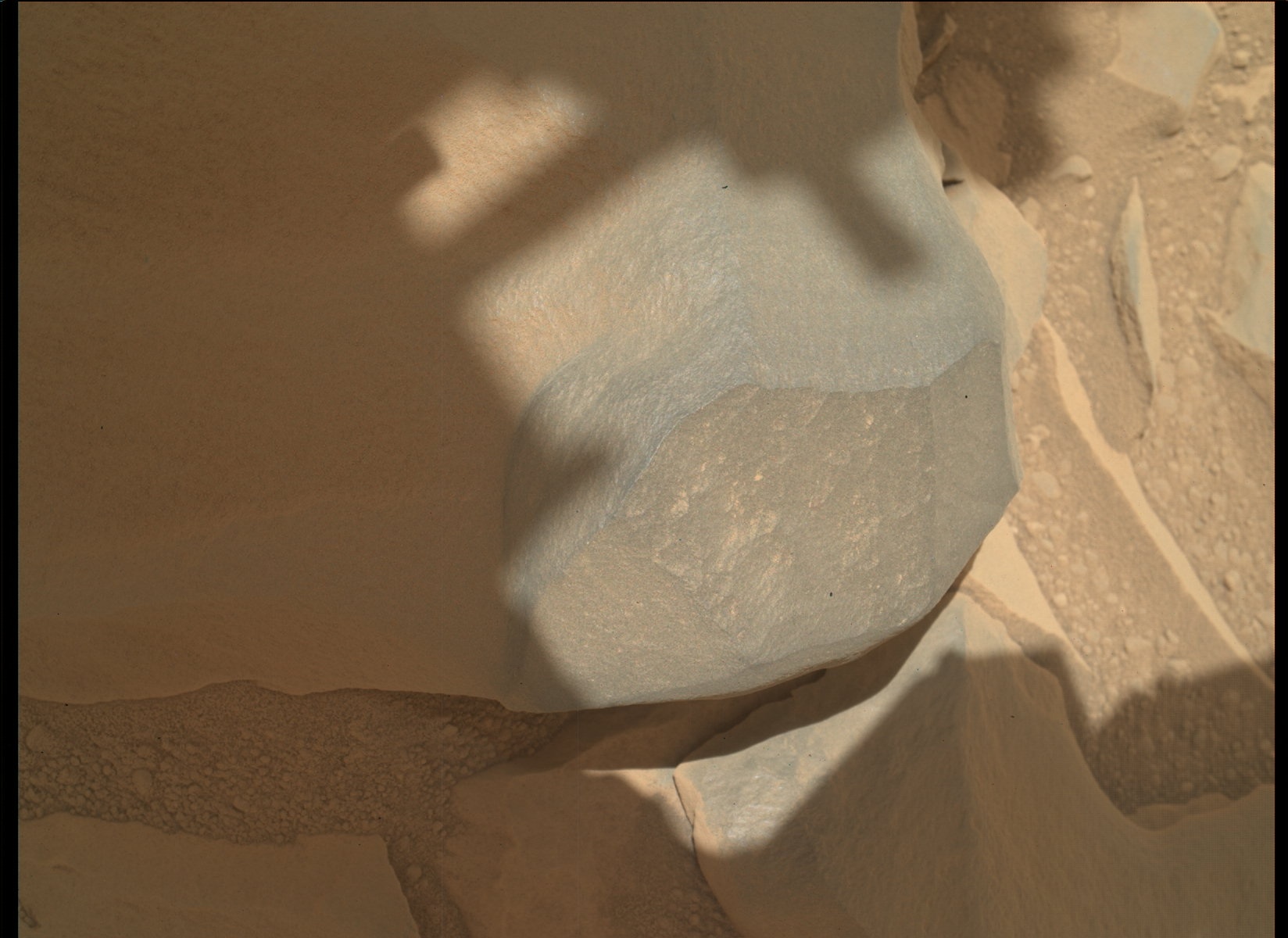
  Emily Lakdawalla of the Planetary Society did an interesting blog yesterday about a tilted rock formation that was photographed over the weekend. We don't have a whole lot of experience with Martian geology and Curiosity's mission could help answer some questions about the physical chemistry of Mars. The rock formation is different from the existing surface material of the "alluvial fan" and may represent a layered deposit. It's not clear what lies beneath it but it looks like it might have been moved by shifting sand.
 
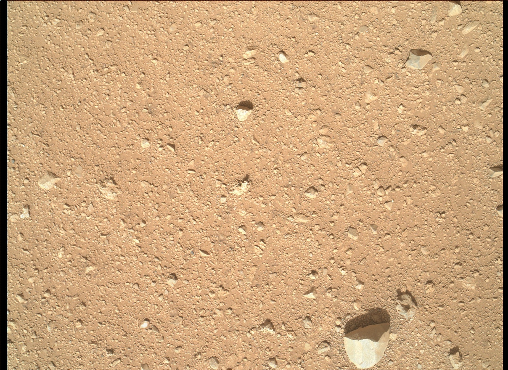
  The Sol 42 Navcam images are pretty much the same as the Sol 41 images with the exception that they appear to have been contrast enhanced. My anaglyph program approved the enhancement. There were some images of the ground near the MSL and I thought I'd focus on them while we are still on this surface.
 
 
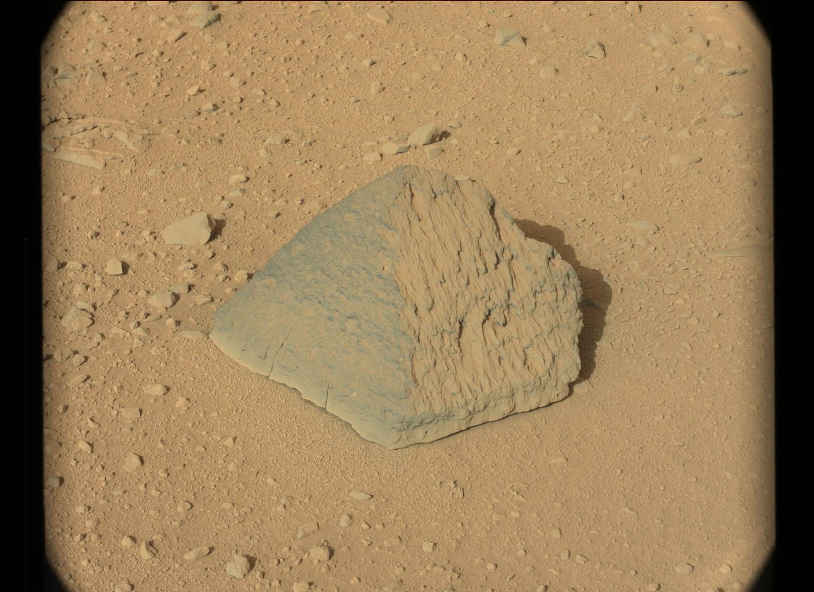
  The curious thing is that there are not may large rocks on in this area. There are some small rocks imbedded in a sandy matrix with some tiny fragments included. The hardness of the surface suggests that the material may have been compressed and compacted by an overlying layer that has eroded away. The fragments look like crushed stone or construction aggregate. The small size of the components may be the result of an aeolian process which favors smaller particles which have a high surface to volume ratio. Rocks fragmenting while rapidly traveling downhill might also produce small particles. Crushed rock used as a paving material is sometimes refered to as "
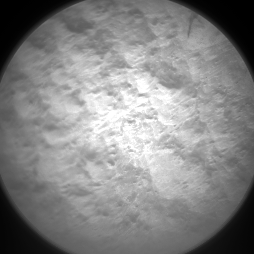
road metal" with metal being a reference to the material as being an ore. The surface does appear to be a desert pavement. The surface appears to be quite fresh and the enhanced images indicate that the wind has left some streaks in it while moving around the larger stones. In some of the images there are linear arrangements of the smaller pebbles which are probably not due to a random process. Curiosity is now on a downhill slope but there doesn't appear to be any signs of stones sliding or rolling downhill. Rapidly moving stones might leave some bounce marks as they skipped along the surface. Another image taken by MAHLI on Sol 33 shows that the surface is mostly tiny pebbles.


Monday, September 17, 2012

Autoenhanced MSL Sol 41 Anaglyphs

 
  I've nearly got the anaglyph creation process automated. The inputs are the raw left and right images and a focal point on the left image with an estimated position on the right. The Mathcad worksheet matches clips to improve on the estimate and uses the left and right histograms to select the contrast enhancement boundaries. A few tweeks now and then are still necessary. On this set of anaglyphs the focal points are near the bottom so you might have to look at the bottom center to start in order to lock onto the stereo image. There appears to be a few image "ghosts" of the larger rocks which may be due to a mismatch between the red-cyan glasses and the primary colors of the computer screen that I am using.